In 1978, all that remained of Puerto Real was buried. The organization of the Puerto Real community was revealed only through archaeology, which make clear that the town’s builders clearly incorporated – and perhaps helped to shape – the principles that were later to be formalized as the ideal design for urban life in the Spanish Americas.
The elements of regular linear organization, concentration of governmental and religious authority in the central plaza, and the spatial segregation of differing residential status groups and production activities can all be documented in the archaeological record of early 16th century Puerto Real. When they were introduced at Puerto Real they were essentially experiments, but the persistence of these elements in Spanish towns of the 18th century and later testifies to their success.
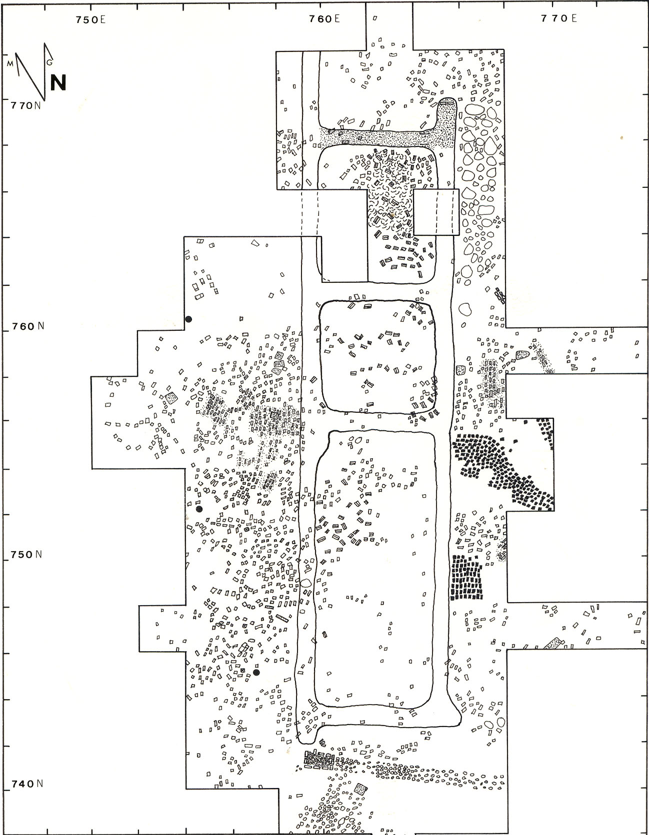
The sub-surface vestiges of the town were revealed through surveys by Jennifer Hamilton, Gary Shapiro, Maurice Williams and Charlie Poe, and through excavations by Ray Willis, Jennifer Hamilton, Rochelle Marrinan, Bonnie McEwan, Charles Ewen and Greg Smith (reported in the chapters by these researchers in Deagan, 1995, Puerto Real). The town paralleled the east side of the now-extinct Fossé River, and its maximum extent was found to cover a regular rectangular about 500 meters north-south by 400 meters east-west (roughly 20 hectares, 200,000 square meters or 50 acres). The densest concentrations of all types of European artifact and structural remains occur in a more restricted area in the center of the maximum rectangle, covering an area of about 290 meters north to south, and 230 meters east to west (about 17 hectares, 66,700 square meters or acres). The size of the town’s population varied considerably through its life, and with it, the areas of occupation.
 The archaeological site of Puerto Real
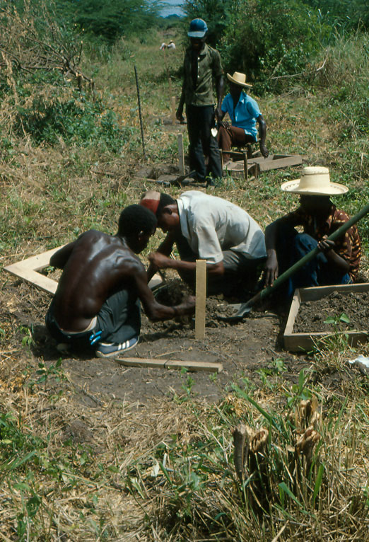
- The sub-surface survey underway at Puerto Real
- Archaeological basemap of Puerto Real, showing locations of sub-surface masonry structures, Maurice Williams, 1982
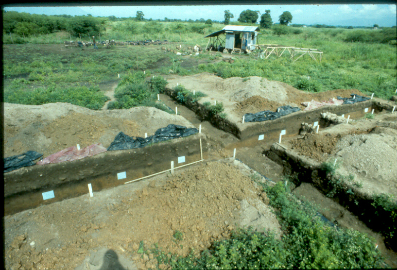

The orientation of the built environment at Puerto Real was extremely regular, suggesting a linear, grid-like organization. All of the structures excavated at Puerto Real are oriented at an angle of approximately 30 degrees east of magnetic north, following the course of the Fossé river.
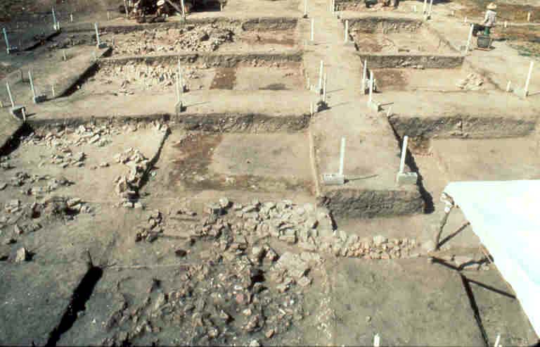
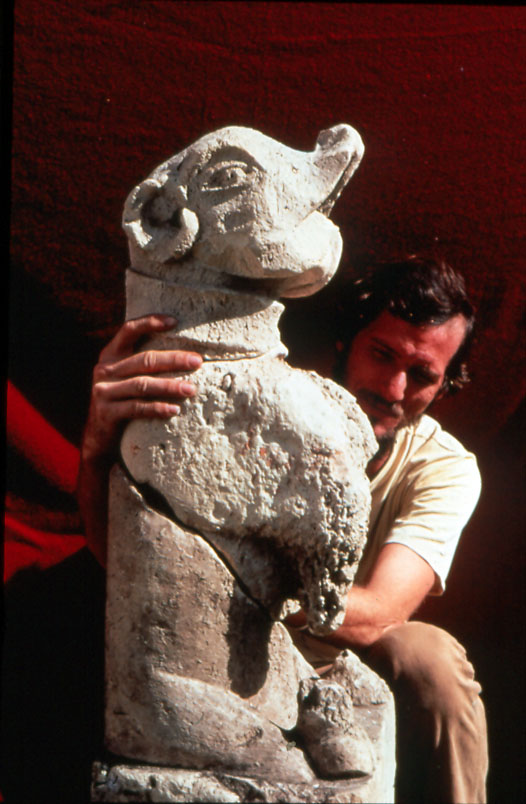
Raymond Willis excavated the town’s church, on the plaza at the center of the town. It measured 7 by 27 meters, and was oriented north to south. A cemetery was to the west, and the plaza to the east. To the north of the church was another massive stone structure partially uncovered by Rochelle Marrinan (1995), thought to be the audiencia (government seat) or possibly the convento (residence of the religious at Puerto Real). These buildings were made of stone, tile and flat brick, and were massively constructed. They featured pillared colonnades, stone gargoyles and decorative tiles, which were found only in these public areas of the town.
- Excavation of Puerto Real church by Ray Willis
- Foundation trench stains of the church structure at Puerto Real
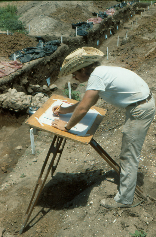
- Archaeological map of the Puerto Real church excavated by Ray Willis
- Limestone gargoyle excavated at Puerto Real, excavated by Jennifer Hamilton
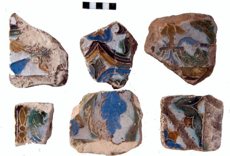
- Spanish Cuenca tiles from the church site
Private homes and commercial enterprises were located around and expanding outward from the central area. Surveys located evidence for at least 49 masonry construction areas, (probably not all occupied simultaneously). Only masonry structures have been excavated at Puerto Real, owing the greater level of confidence with which masonry structures could be located through the sub-surface test program. There were undoubtedly many more as-yet-undocumented humbler wood and thatch buildings at Puerto Real. There is no archaeological evidence so far to indicate that wattle and daub construction was used by the Spaniards at Puerto Real, although it was used commonly by the previous Taíno and subsequent African populations in Haiti.
Floorplans were typically based on multiple rooms laid out in a linear arrangement around or alongside a patio (although no complete residential structure has been excavated at Puerto Real). Excavations by Bonnie McEwan and Charles Ewen at domestic structures have shown that stone footings, tiled patios or floors, brick drains and brick pavements were used in combination with wall-trench and post walls. Structures were not always meticulously square. Rows of large limestone rocks were located parallel to the exterior post walls of all three excavated sites at Puerto Real. These appear to have been remnants of debris collected along a structure wall, or elevated stepping stones.
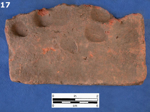
Decorative majolica floor and wall tiles were rare at the domestic sites, although they were well-represented at the large central structure believed to have been the church. All sites at Puerto Real incorporated flat ladrillo bricks in walls and floors, and curved barrel rooftiles (teja).
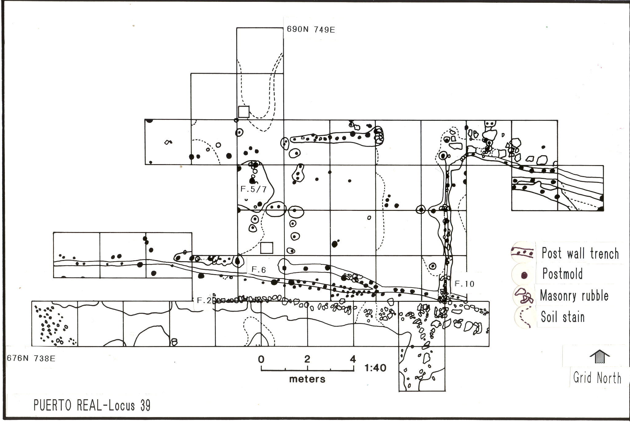
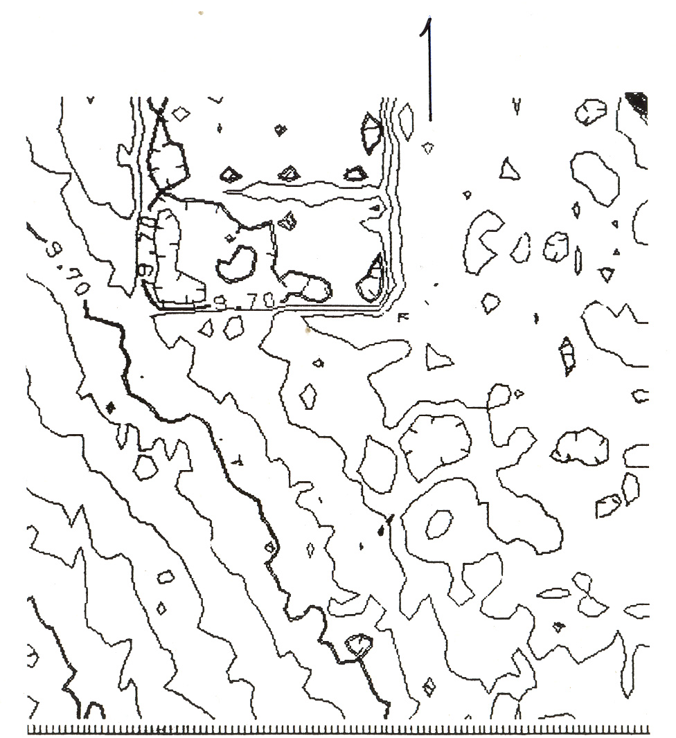
All of the domestic structures excavated so far at Puerto Real showed evidence for lot boundary walls, in some cases forming part of the structures themselves in addition to serving as a boundary. Some of these structural complexes were quite large, such as the lot indicated by the boundary wall at Locus 19, which extends for more 32 meters, and that of Locus 39, which extends for more than 25 meters. Another building, although not excavated, is clearly evident in the topographic contour map prepared by Charles Poe and Maurice Williams and clearly shows the walls of the complex that measure approximately 40 by 20 meters.
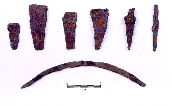
The enclosed occupation complexes of Puerto Real probably contained not only the living areas for the inhabitants, but also animal corrals, gardens and possibly commercial or light industrial activities. No water wells have been located. The structural complex known as “Locus 39” was probably a commercial area, and was related to the cattle hide industry. It contained a remarkable assemblage of cattle remains and hide-working tools.
- Map of masonry structure at Puerto Real, excavated by Jennifer Hamilton
- The sub-surface survey underway at Puerto Real
- Detail of Puerto Real topographic map showing a 2-room structure
- Metal tools from the locus 39 cattle processing area