Surveys located evidence for at least 49 masonry construction areas, (probably not all occupied simultaneously) and there were undoubtedly many more post, board and thatch structures.
There is no archaeological evidence so far to indicate that wattle and daub construction was used by the Spaniards at Puerto Real, although it was used commonly by the previous Taíno and subsequent African populations in Haiti.
Only masonry structures have been excavated at Puerto Real, owing the greater level of confidence with which masonry structures could be located through the sub-surface test program. There were undoubtedly many more as-yet-undocumented humbler wood and thatch buildings at Puerto Real, but these remain to be documented archaeologically.
 Map of masonry structure at Puerto Real, excavated by Jennifer Hamilton
- The sub-surface survey underway at Puerto Real
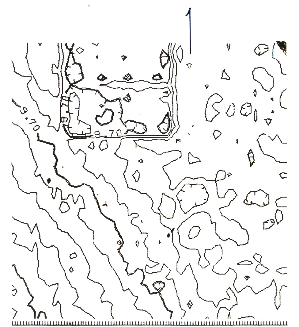
- Detail of Puerto Real topographic map showing a 2-room structure
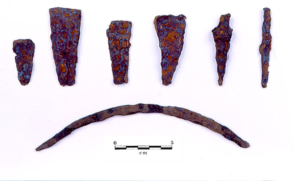
- Metal tools from the locus 39 cattle processing area

Multiple rooms laid out in a linear arrangement around or alongside a patio appears to have been a dominant mode for floorplans (although no complete residential structure has been excavated at Puerto Real). Excavations by Bonnie McEwan and Charles Ewen at domestic structures have shown that stone footings, tiled patios or floors, brick drains and brick pavements were used in combination with wall-trench and post walls. Structures were not always meticulously square. Rows of large limestone rocks were located parallel to the exterior post walls of all three excavated sites at Puerto Real. These appear to have been remnants of a footing, the remnants of debris collected along a structure wall, or elevated stepping stones.
Decorative majolica floor and wall tiles were found only infrequently at the domestic sites, although they were well-represented at the large central structure believed to have been the church. All sites at Puerto Real incorporated flat ladrillo bricks in walls and floors, and curved barrel rooftile (teja).
All of the non-public structures excavated at Puerto Real showed evidence for lot boundary walls, in some cases forming part of the structures themselves in addition to serving as a boundary. Some of these structural complexes were quite large, such as the lot indicated by the boundary wall at Locus 19, which extends for more 32 meters, and that of Locus 39, which extends for more than 25 meters. Another building, although not excavated, is clearly evident in the topographic contour map prepared by Charles Poe and Maurice Williams and clearly shows the walls of the complex that measure approximately 40 by 20 meters.
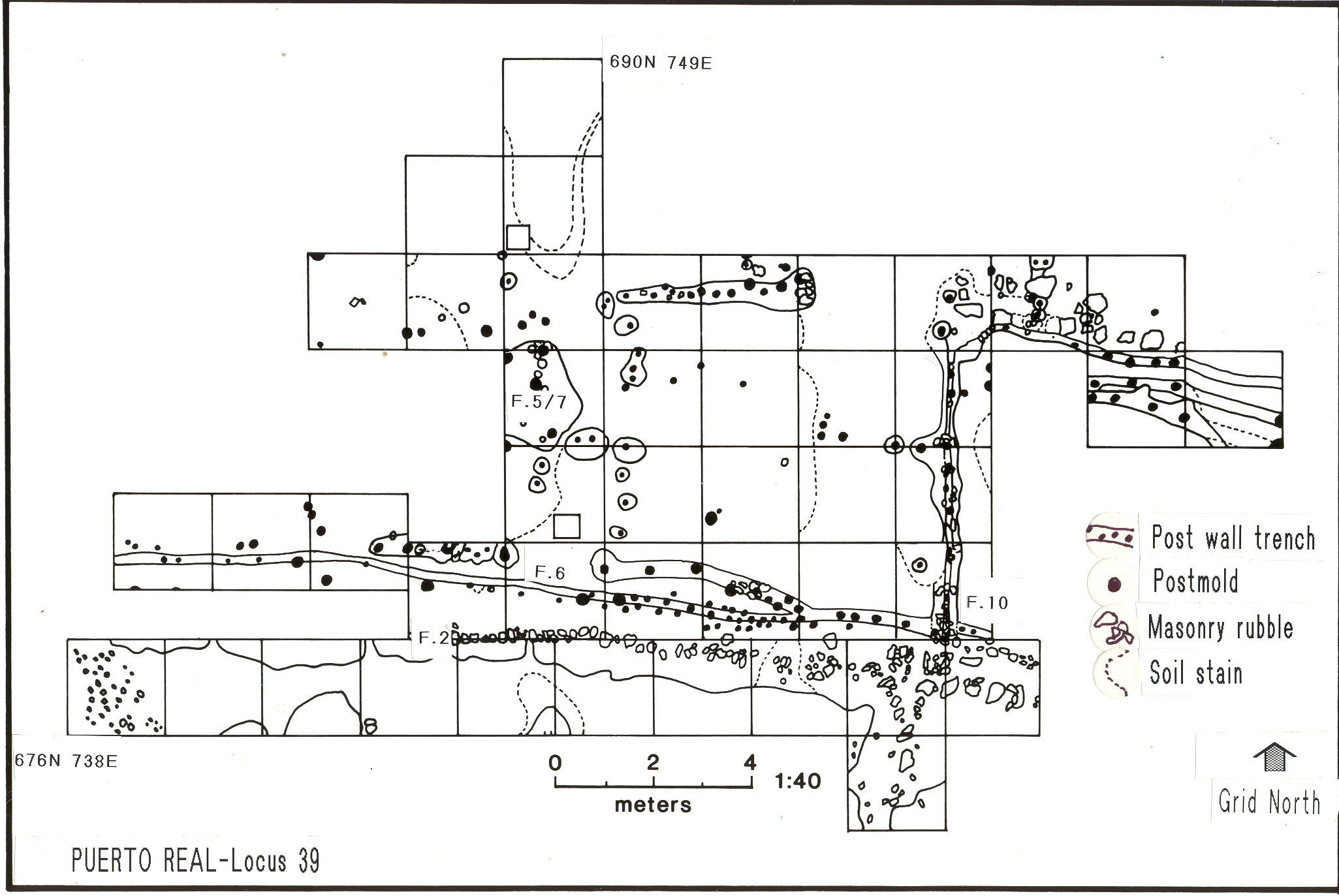
The enclosed occupation complexes of Puerto Real probably contained not only the living areas for the inhabitants, but also animal corrals, gardens and possibly commercial or light industrial activities. No water wells have been located. The structural complex known as “Locus 39” was probably a commercial area, and was related to the cattle hide industry. It contained a remarkable assemblage of cattle remains and hide-working tools.