The site of En Bas Saline was first located and tested in 1977 by medical missionary and avocational archaeologist William Hodges of the Hopital le Bon Samaritain in Limbé, Haiti, as part of his lifelong search for Columbus’s lost fort of La Navidad.
Dr. Hodges was shown elaborate Taíno pottery by patients who came to his clinic in Limbé, and later showed him the site from which the pottery came. The site at the tiny village of En Bas Saline was unknown at the time, at least partly because of the difficulty getting to it. Dr. Hodges recognized at once that it was a large, important Taíno center, very close to where the Santa María was sunk. He mapped and carried out test excavations at the site, and the results led him to bring En Bas Saline to the attention of the University of Florida.
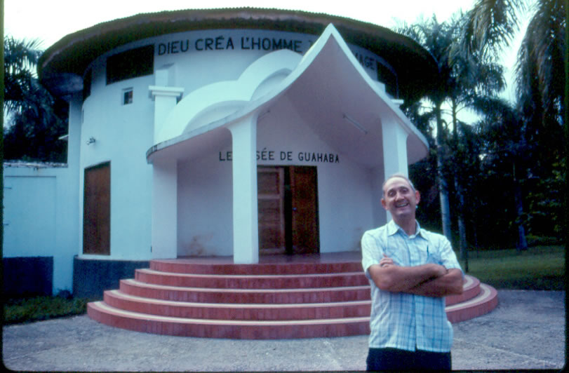
A collaborative program of survey, mapping and excavation was carried out at En Bas Saline between 1983 and 1988 by the Florida Museum of Natural History, the Bureau National d’Ethnologie d’Haiti and the Musee de Guahabá in Limbé. Field excavations were also carried out in 2003, confirming the central mound as a large structure burned in the late fifteenth century. A musketball was found among the burned remains. Post stains from two pre-Columbian structures were also located.
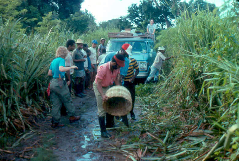
 The road to En Bas Saline
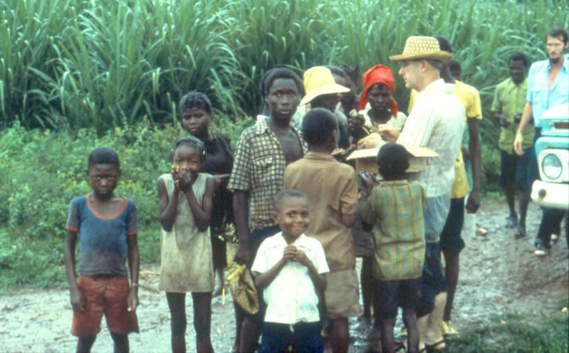
- Dr. William Hodges
- Dr. William Hodges with En Bas Saline residents
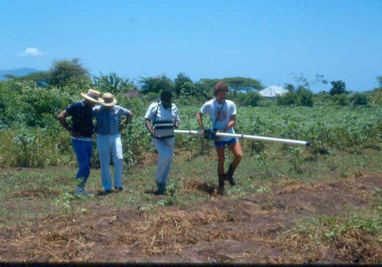
- Electromagnetic survey in progress
- Base map, En Bas Saline
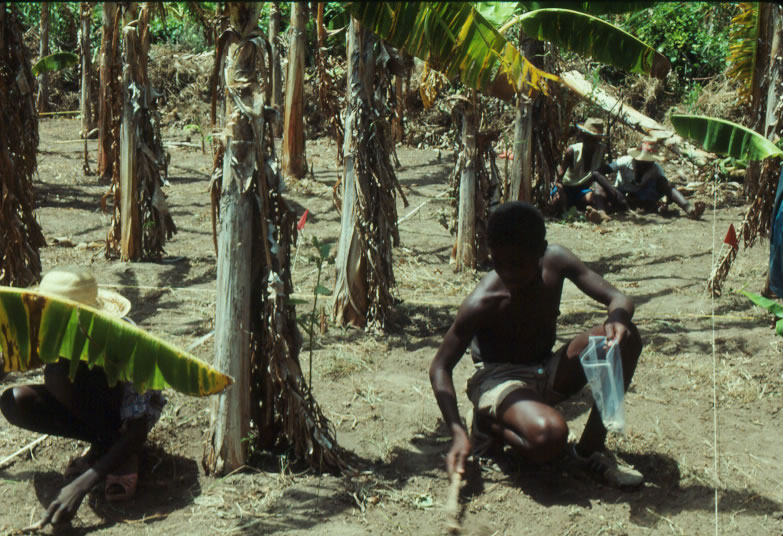
- Surface collection
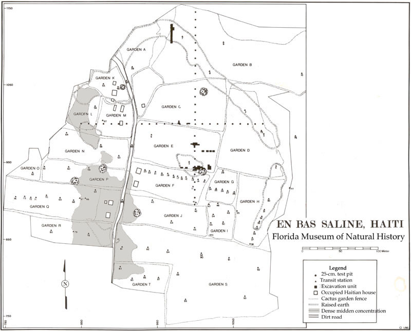
The Taíno town at En Bas Saline was roughly oval, oriented from northwest to southeast, and is bounded by a curved, raised earthen ridge in the shape of a squared “C”, open to the south and southwest There is an opening in the ridge forming the eastern boundary of the site that may have been a “portal” into the town. The ridge is about 20 meters across, with elevations ranging from 50 to 80 centimeters above the surrounding areas.
During the first years of the project, the entire site was surface-collected. Distribution of the surface materials from the site (representing total coverage) reveal that the densest Taíno occupation refuse midden is also concentrated in a squared “C” shape, opposite to and in a mirror image of the raised earthen ridge. The ridge and the midden are separated by a flat, open area that is relatively clear of refuse, and is presumed to have been a plaza, dance court or ball court.
Three raised areas (approximately .8 meters in elevation and from 15 to 30 meters across) are aligned east to west across the plaza area, dividing it into two sections. Following what is known of Taíno town organization, these are presumed to be elite residential areas, a the most elaborate pottery and other materials are found here.
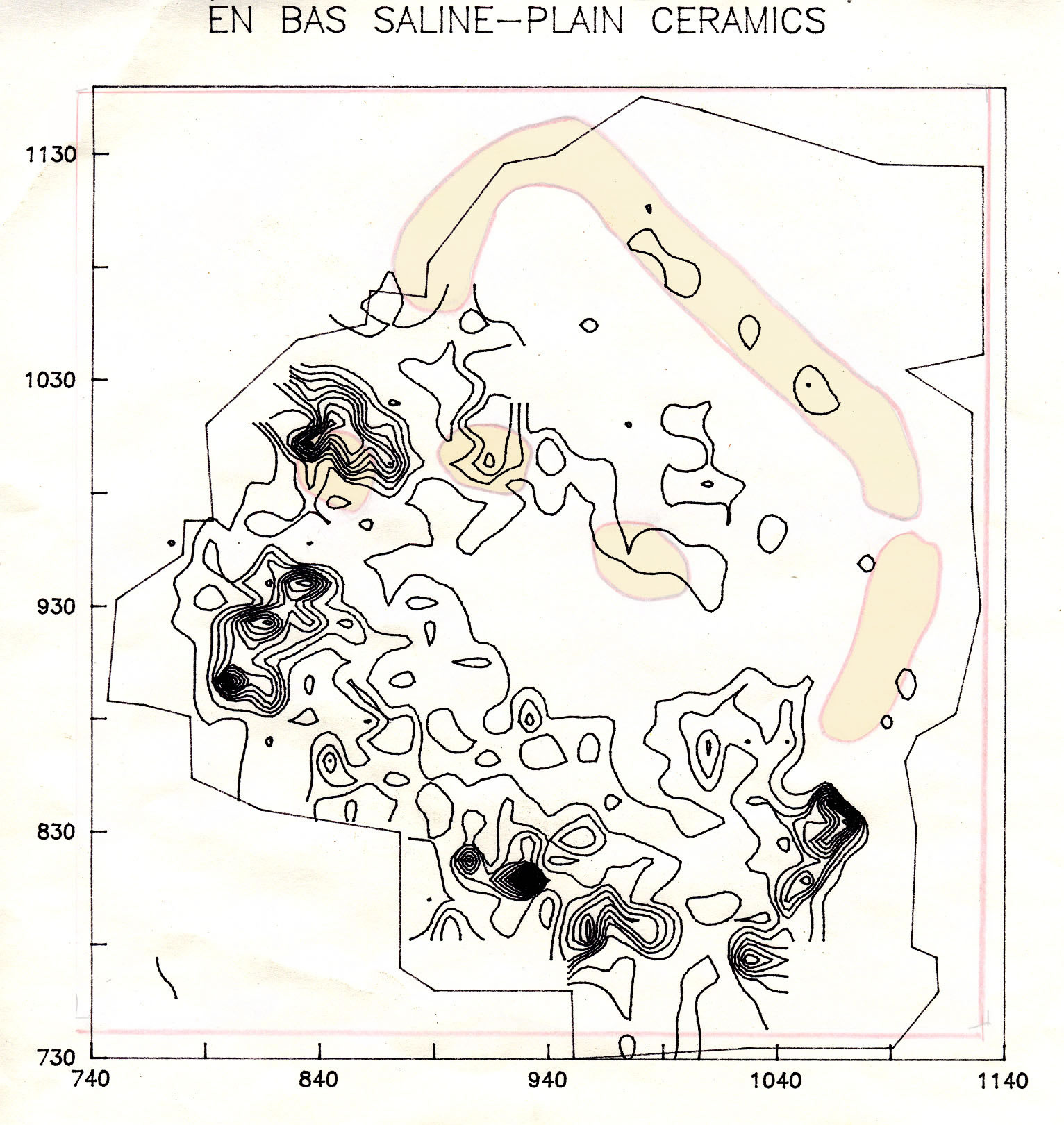
- Distribution of surface collection artifacts at En Bas Saline
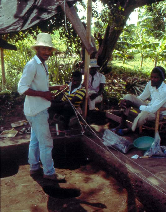
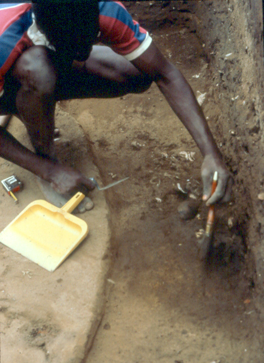
- Excavations at En Bas Saline
- Excavations at En Bas Saline
- Excavation of the earth perimeter ridge
- Archaeological features on the central mound

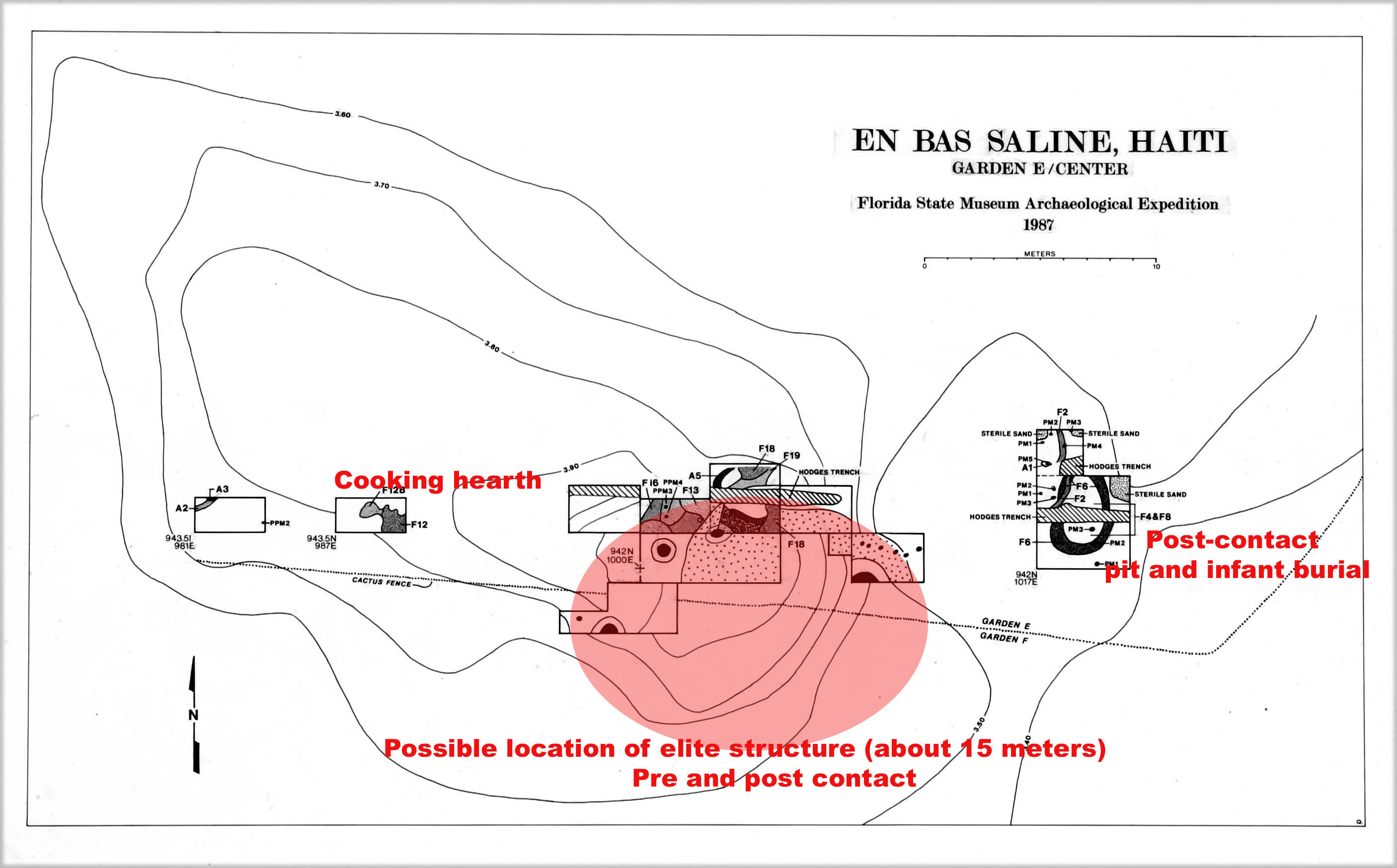
Between 1984 and 2003, a total of 276 square meters of area was excavated at En Bas Saline. Radiocarbon dates from the lowest soil layers and features at the site indicate an initial date of occupation at around AD 1250, and continuous occupation into the historic period is supported both by post-1492 European materials and radiometric dates.
Excavations have concentrated on the central and largest mound (as a chiefly residence), the earth ridge bounding the site (to understand its chronology, construction and function), and several locations in the plaza area that contained electromagnetic anomalies.
The earth ridge was apparently constructed purposefully in a single episode prior to contact, with a series of borrow pits on the village side, and a very low density of cultural material in the ridge fill. The ridge does not seem to have been used for domestic occupation before Spanish contact, but rather served as a boundary for the village or for a plaza. A portion of a small wattle and daub structure accompanied by refuse deposits was located on the top of the earthen ridge, and was occupied exclusively during the post-contact period.
The central mound excavations revealed remnants of at least two very large, presumably elite, superimposed or re-used residential structures. They were oval in shape, exceeding 15 meters in diameter, and were supported by posts measuring at least 50 centimeters in diameter. The initial structure was probably constructed between AD 1200 and 1250 and burned at least twice during its occupation. It burned for the first time during the second half of the thirteenth century and then again during the early post-contact period, indicated by the presence of European elements in several of the structure’s later posts and burned fill layers.
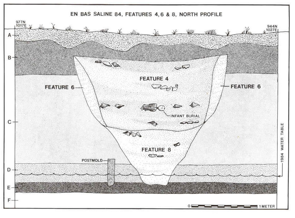
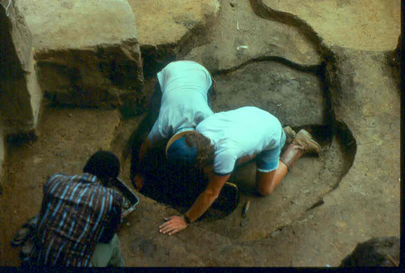
Adjacent to, and probably outside the building on the mound, Dr. Hodges located a deep pit in which the remains of an infant were interred. Included in the fill of the burial pit were large quantities of ceramics (many elaborately molded) and what we interpret to be the remains of feasting. A post-contact date for the burial is confirmed both by the presence of Sus scrofa (pig) and Rattus rattus (rat) bones in the lowest levels of the feature (underlying the burial), and also by radiometric dates. Neither rats nor pigs were in America before the arrival of Columbus.
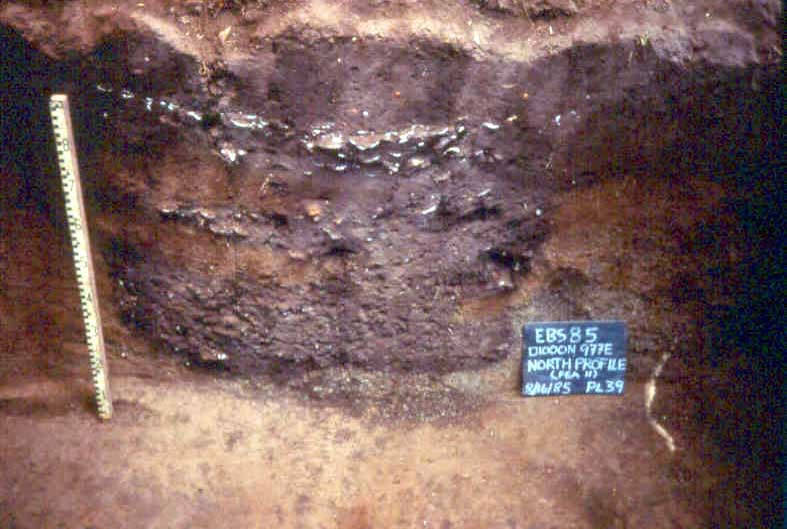
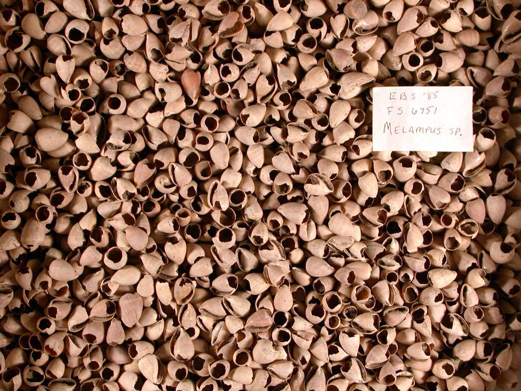
The electromagnetic survey in the plaza located two very large, deep pits between the central mound and the earth ridge. The pits were rectangular and straight sided, measuring approximately one by two meters, and extending to a depth of more than 1.5 meters. They were filled with ceramic vessel fragments, broken ceramic griddles, burned manioc tubers, animal bone, layers of ash and shell, and were apparently used for communal feasting.
- Cross section of ca. 1492 infant burial pit
- Excavation of the burial pit feature
- Cross section of feast pit in central paza area
- Thousands of Melampus (coffee bean snail) shells.
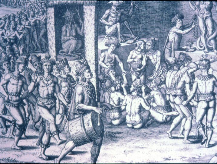
- A Brazillian Indian areito depicted in a 16th century engraving by Theodore de Bry.