“The Everglades is a test. If we pass it, we may get to keep the planet.” – Joe Podgor
What is it?
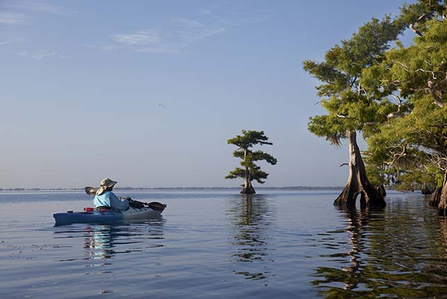
The Everglades is possibly the most important ecosystem in Florida but has faced detrimental consequences from rapid urbanization and anthropogenic development. It was established in 1947 as a National Park, with over 1.5 million acres. Quickly after, it became internationally known after the publication of The Everglades: River of Grass by Marjory Stoneman Douglas. This book helped reframe public understanding of the Everglades—not as a useless swamp, but as a slow-moving, life-sustaining “river” full of biological richness. Currently, the Everglades spans a vast region of slow-moving water, wetlands, and marshes and is home to over 4,000 species of plants and animals (iNaturalist), including the oldest cypress trees and the largest continuous seagrass meadows on Earth.

The Everglades functions not only as a biological refuge but also as a key component of Florida’s natural water cycle, contributing to the freshwater supply, flood control, and coastal ecosystems.
Due to decades of environmental degradation from urban development, agriculture, and drainage projects, the Everglades faced severe ecological damage. After work from many conservationists, Congress authorized the Comprehensive Everglades Restoration Plan (CERP) in 2000. This is the largest hydrological restoration project ever undertaken in the United States, aimed at restoring natural hydrology, improving water quality, and reviving ecosystem function.
The CERP is not just one action, but a collection of projects across the Everglades watershed. It involves collaborations between the US Army Corp of Engineers, South Florida Water Management District, Tribes in South Florida, local governments, the Everglades Foundation, and many more, all with one goal: to restore the Everglades.
Why it happened?
The deterioration of the Everglades stems from a long history of altering natural water systems to make way for urban expansion, agriculture, and flood control. These interventions altered the natural flow of water, especially from the Kissimmee River to Lake Okeechobee and south into the Everglades.
Before we talk about what people picture as the current Everglades, we need to talk about some major areas in Florida.
- Kissimmee River:
 The Kissimmee River is where this restoration project began. After this originally 103-mile winding river was transformed into a 56-mile canal in the 1960s for flood control, major detriments to the natural flow of the wetlands occurred. This transformation destroyed natural water filtration systems, reduced biodiversity, and led to major flooding events in the surrounding area. However, over 40-miles have been restored to a more natural state, and this has helped to mitigate floods and restore biodiversity.
- Lake Okeechobee:
 Historically, Lake Okeechobee was a part of this natural system to feed the waterways in the Everglades, and as part of the water cleaning cycle in Florida. Flood-control structures, however, have limited water flow southward, and instead directing it east and west. This change in water flow has contributed to harmful algal blooms and reduced water flow in the Everglades, causing a series of driest years in the history of the Everglades. Helping Lake Okeechobee recover is a part of creating a balance in the Everglades.
Where is it now?
Significant progress has been made towards restoring and protecting the Everglades system, and it’s in major part due to the work of the CERP.
One more current win for the Everglades was the authorization of the Central Everglades Planning Project (CEPP) in 2016. CEPP focuses on restoring water flow through the central Everglades—essentially the missing link in reconnecting the ecosystem. Restoring this area is key to connecting Lake Okeechobee back to the Everglades and restoring a threated ecosystem.
Check this timeline to learn more about both historical and current happenings in the Everglades.
Information from Everglades Law, Everglades Foundation, and the National Park Service. Everglades map from the USGS, Kissimmee River image from South Florida Water Management District, and Lake Okeechobee image from FWC.