For those of you who spent time near the center from January to early March of this year, you might have noticed something buzzing around in the distance.
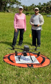
Jen Green (South Florida Archaeology Collections Manager, FLMNH) and Daniel Spikowski (Calusa Land Trust) were a couple of the participants in a drone-based mapping and imagery course instructed by Jim Blanchard, ScD of the Unmanned Autonomous Systems Academy (UASA) and Johns Hopkins University. The RRC was a great place to host the “field” portion of the course. Green and Spikowski joined other professionals from across the country to learn the implementation of aerial mapping using drones in a broad array of contexts including from the land and by boat, two important skills for working on Pine Island.
Green and Spikowski earned their Federal Aviation Administration (FAA) remote pilot certificates to operate drones under Part 107 of the FAA’s code for small, unmanned aircraft systems (UAS) for drone operations that cover a broad spectrum of government and research purposes.
So, what purposes could the RRC use drones for – you might ask?
That’s a great question!
- Comprehensive Property Coverage: The team flew several missions to map the entire RRC As the drone flies overhead, a series of photographs are taken using software-controlled timing and set distances in an overlapping grid pattern. Once the mission is completed, the data (i.e., photographs and GPS points) are uploaded into a computer software system. The software then uses the information from the overlap- ping photos to stitch together a comprehensive aerial map of the property.
- Documenting/Tracking Property Vegetation: Using the same technique as above, the same mission of mapping the property can be carried out on a semi- annual or annual basis to track vegetative growth and changes to the property after storm activity, fires, droughts, or cyclical seasonal Using drones to complement boots on the ground vegetation surveys will help us to render as detailed as possible assessments of site vegetation, including evaluating overall percentage changes of vegetation on the landscape using computer software to estimate biomass changes from mapping event to mapping event.
- Public Outreach and 3D-Site Models: Instead of flying the drone with the camera straight down, Green, Spikowski, and Blanchard also flew the same overall site grids but this time with the camera angled at 45° Because of the camera angle, the drone can capture images underneath the dense tree canopies across the property. The structures captured in the software (i.e., the trees) can then be manipulated to see through the canopy to the ground surface, or even be removed to visualize what the surface and shapes of the various mounds on the property look like.
- Calusa Mapping: Different types of sensors (e.g., Light Detection and Ranging – LiDAR) can be mounted onto drones to detect infrared changes and thus identify low and high elevation zones both from the UV signal plants give off, and from standing water areas (or those that are highly saturated). The team flew missions across the Grand Canal and followed it east down Brian Wilder’s property (RRC neighbor, permission received before flight).
- Shoreline and Environmental Assessments: The team also assisted our long-time friends and partners at the Calusa Land Trust (CLT) to map and document shore- line erosion and mangrove habitats on Calusa Island on the north side of Bokeelia near Jug Creek Marina. The CTL plans to operate missions throughout the years to document long distance sand/sediment dispersal across the property’s shoreline and to track mangrove propagation success as land management tools to better understand how to protect the sensitive tropical hardwood hammock ecosystem.
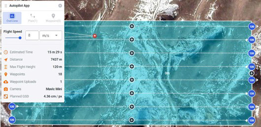 Example of an automated drone mapping mission using a grid system. Photo by Annisa Karim
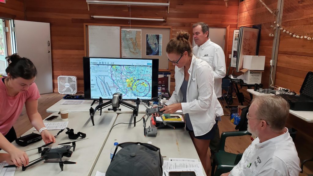 Jen Green (center), manager for the South Florida archaeology and ethnography learns how to set-up her drone (RRC Classroom). (Photo by Annisa Karim

We are very excited to have conducted this work at the RRC and on Calusa Island this year. Incorporating new technologies to the field of archaeology brings a wealth of new information for us to explore, opportunities to train students, and to share these stories with the public. And for those of you itching to know about the beloved ospreys at the RRC, they sat perched in the gumbo limbos and the telephone pole nests keeping an eye on the team but were not troubled or agitated by the new buzzing activity.
This article was taken from the Friends of the Randell Research Center Newsletter Vol 22, No. 1 & 2. November 2023.