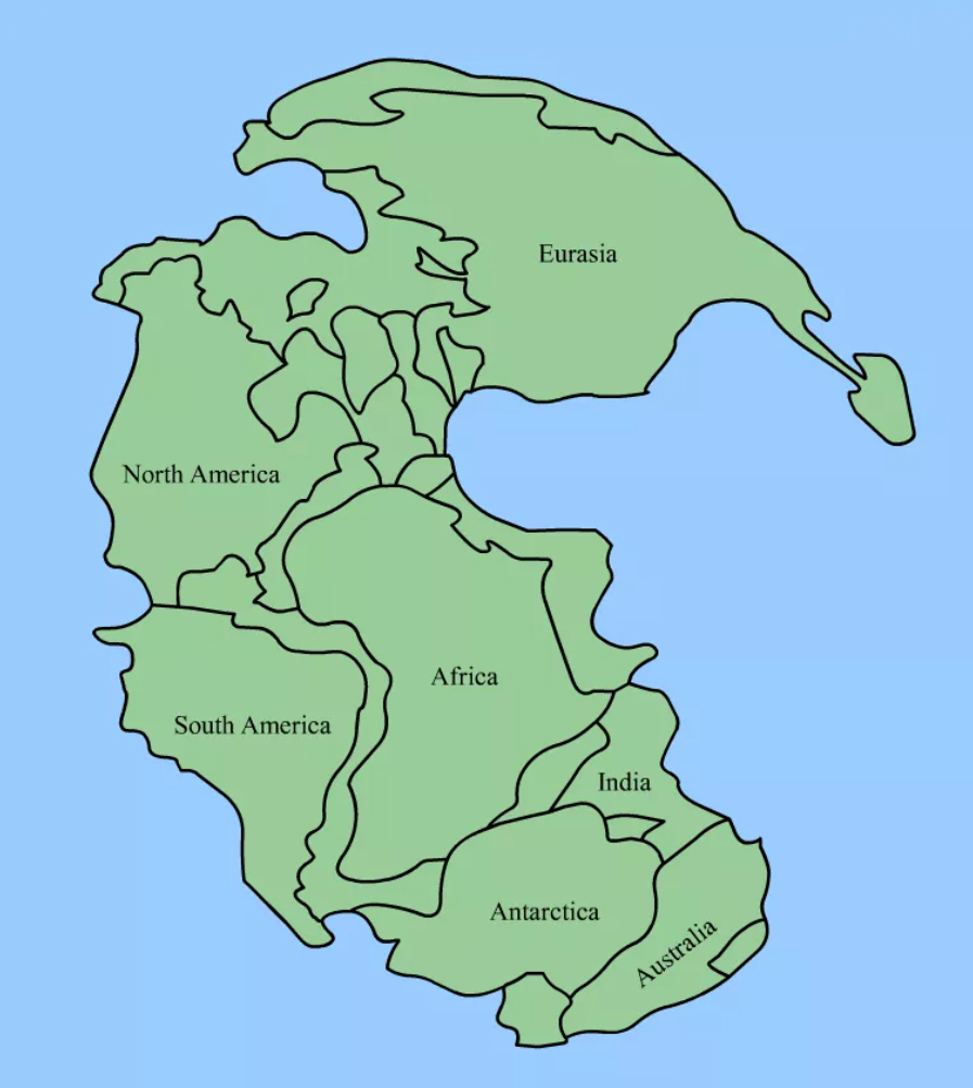
Use fossil and rock evidence to reconstruct how the Earth may have looked approximately 290 million years ago when the continents were connected to form a supercontinent called Pangea.
Pangea Analyzing Evidence Worksheet
Materials
- World map
- Landmass puzzle pieces
- Pangea Map Symbols handout
- Analyzing Evidence Worksheet
Engage
Show students a current map of the world and ask them to name the continents. What do you observe about the shape of the continents? Some of the continents look as if they fit together like the pieces of a puzzle. Discuss how South America and Africa may fit together. Do you think other continents fit together?
About 100 years ago, a German scientist named Alfred Wegener made the observation that continents fit together. This led him to suggest a new idea that the continents were once part of a single piece of land called Pangea. It split apart millions of years ago and the continents moved to their present position. Others had recognized the fit of Africa and South America, but it was Wegener who gathered other scientific data to support his theory.
Explore
Working in small groups, students will piece together the supercontinent Pangea based on fossil and rock evidence found on present day continents.
- Introduce the Pangea Map Symbols. Identify the symbols and discuss that these animals and plants once lived on Earth.
- Give each group the landmass pieces and have students arrange them into Pangea.
If students need assistance, provide these hints:
- Observe continent shapes on the world map to help them decide if any appear as if they might fit together.
- Look for all of the pieces with the fossil remains of Cynognathus and put them together first (South America and Africa).
- Put all of the landmasses with Glossopteris and Lystrosaurus near each other. Notice how two of the continents (Africa and Antarctica) have the end regions of Lystrosaurus.
Explain
- How did continent shape help in deciding where to place the continents? Which two continents have the most obvious fit of the coastlines?
- How did the fossil and rock evidence help in deciding where to place the landmasses?
- Which fossil occurs on most of the landmasses? What does that suggest when these particular continents broke up?
- Locate Florida. To which continent was it once attached?
Extend and Evaluate
- Have each group explain their Pangea arrangement.
If students don’t get the “correct” answer, have them explain their thought process and how they used the evidence to arrive at their conclusion.
Students should understand that using the shape of the continents to fit them back together is using one type of evidence. Using the presence of the same type and age fossils is another. The presence of the same rock types is another form of evidence. Ask students if they can think of other types of evidence to search for that might be useful in solving their puzzle.
- Have students use Wegner’s Evidence for Continental Drift to write a paragraph to explain what their map shows about the Earth 290 million years ago. Explain how the fossil evidence helped to piece the landmasses together.
There is much information missing from the picture. For example, ancient shorelines were not the same as they are today due to changes in sea level and the tectonic process (continents colliding and pulling apart, causing rocks to be added or torn off). Scientists still debate the fine details of paleogeographic (ancient geography) reconstruction. It is more important to have students grasp the concept of how scientists look for clues, or evidence, and put the pieces together to solve a problem.
- Complete the Analyzing Evidence Worksheet.