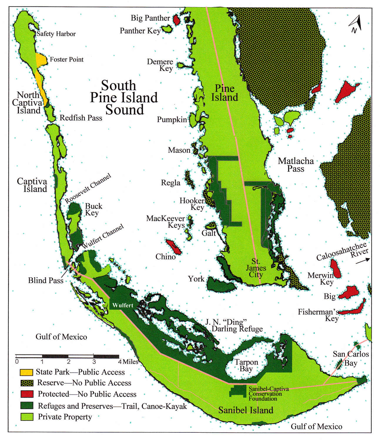
Sanibel Island is the largest and southernmost island among barrier islands of Pine Island Sound. At 12 miles long and 2.5 miles wide it is the only one in this region that orients mostly east to west due to bedrock formations.

A strong, longshore current along the entire west coast of Florida carries white quartz-crystal sand from north to south along the barrier-island chain, depositing sand in the northern parts of barrier islands and eroding at passes and inlets. Extreme accumulation occurs near the Sanibel-Captiva Bridge. Wulfert Channel flows under that bridge, carrying water and sediment from Pine Island Sound into the Gulf of Mexico, eroding portions as it goes, and sometimes filling up with sand. Accumulations of sand from earlier times formed the northwestern portion of Sanibel Island.
Sanibel Island has one of the oldest standing beach-ridge sets of today’s barrier islands. The earliest trace of wave action is more than three thousand years old. Beach ridges appear in the J. N. “Ding” Darling National Wildlife Refuge, deposited from south to north. The earliest sets indicate an episode of sea level between one and two feet lower than present.
One of the most significant archaeological sites on the island is the Wightman Site. In 1895 Frank Hamilton Cushing, archaeologist with the Smithsonian Institution, described it as “an advanced key” with canoe channels along shell ridges lined with mangroves and graded ways (shell ramps) leading up to at least three shell platforms at various levels. In the 1940s, archaeologist John Goggin of the University of Florida described it as an “elaborate series of embankments, platforms, mounds, and other features.” Goggin observed several hundred potsherds, chert, and shell tools, but wrote they were taken out of context by landowner G. J. Kesson who had displayed artifacts haphazardly. Dr. Goggin guessed, based on the potsherds, that the site might have been occupied by humans beginning about 2400 years ago.
In 1974 the owner of the site, Karl Wightman, gave his consent to anthropologist Dr. Charles J. Wilson to conduct archaeological work. Over the next two years, one visible mound and a flat courtyard were formally excavated. It was a race with bulldozers.
By 1995 only one part of one mound remained untouched by construction. Upon this remnant, geologist Frank W. Stapor, zooarchaeologist Karen J. Walker, and archaeologist William H. Marquardt collaborated on a study to refine the timing and magnitude of sea level changes, salinity, temperatures, storms, sediment deposits, erosion, and intervals of habitation and abandonment recorded in ancient layers of the mound.
The lower shell midden showed evidence of people starting around 2400 years ago and lasting about 800 years. Then it was flooded and abandoned for 200 years. Afterward, the same lower shell midden was occupied and built upward. It remained occupied for another 300 years. This confirmed Dr. Goggin’s estimate of its earliest date and verified regional sea-level fluctuations and their approximate dates.
By 1978 an intensive survey of the Ding Darling National Refuge was performed. Eleven prehistoric sites were recorded, including eight in the mangrove-wetlands and three on the upland-dunes. The sites included an upland shell site without ceramics, a late prehistoric and post-European contact site with an associated canal, a possible burial mound, single burial sites, two shell middens with plain sand-tempered ceramics, and six shell middens in the mangrove swamp environment.
The eventual decision by Sanibel Island residents to protect lands that included vulnerable archaeological sites was essential and far-reaching. Today, visitors to J. N. “Ding” Darling National Wildlife Refuge can walk the boardwalk at the Wulfert mound and contemplate how indigenous people of the island survived, adapted, and remained resilient through centuries of time.
This article was taken from the Friends of the Randell Research Center Newsletter Vol 19, No. 3. November 2020.