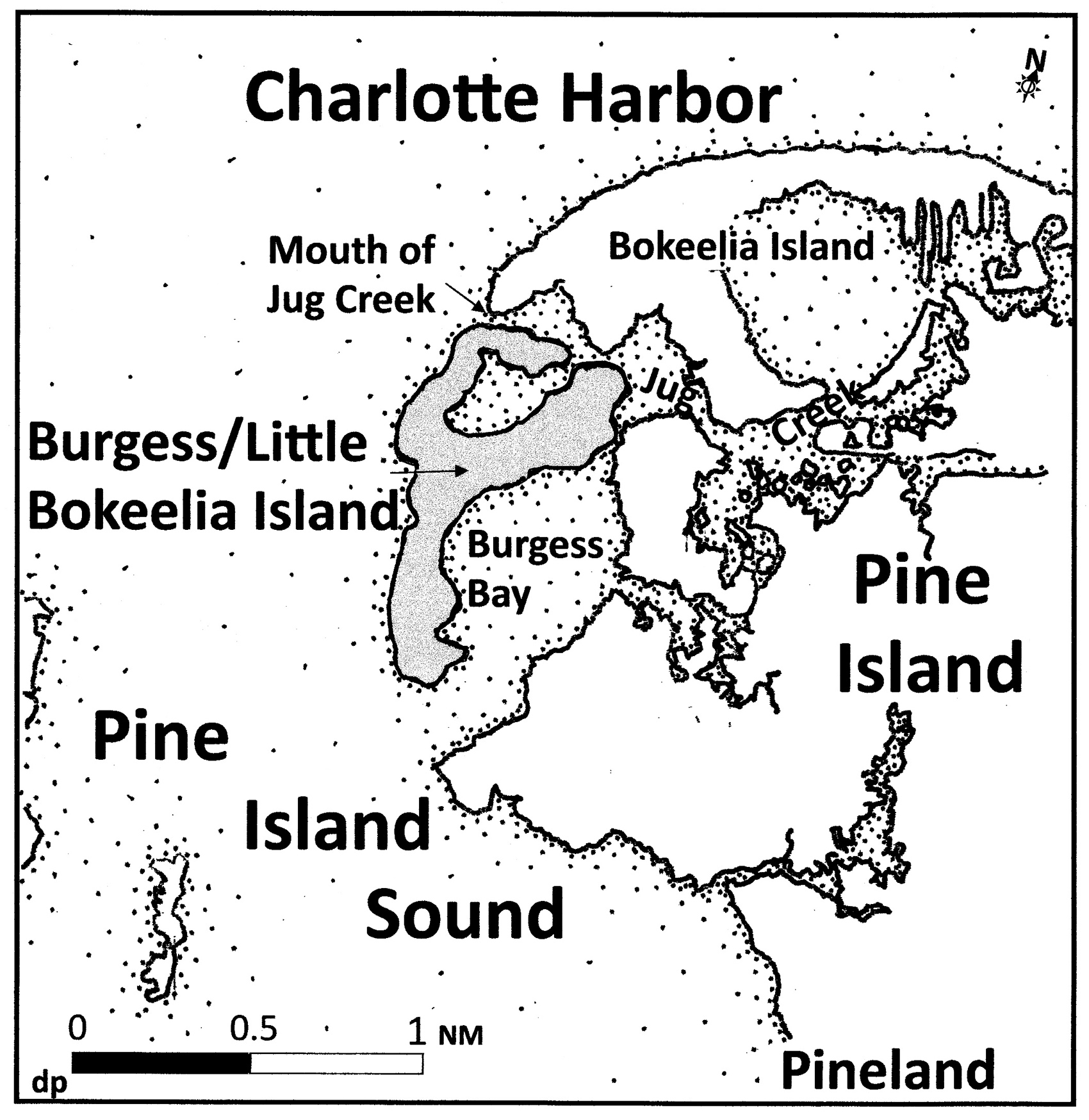
Burgess Island has been its name for ninety years, but prior records show the name as Little Bokeelia Island. This article recognizes both: Burgess/Little Bokeelia Island.
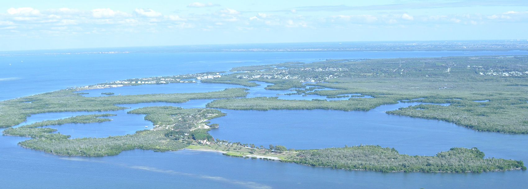
Geologically, the core of the island is a series of ice-age sand dunes with elevations of at least twenty feet. Today this relatively high base supports 29 upland acres of a total of 104. In ancient times, the sand dunes accumulated along the margin of a primeval river flowing across lands now submerged by Charlotte Harbor and Pine Island Sound.
Over millennia, this island has survived countless changes in sea level. Ten thousand years ago, the Gulf of Mexico was at least 60 miles west of the island. About four thousand years ago, the waters of the Gulf of Mexico flooded Pine Island Sound. Its waters rose at least another two feet higher than today’s levels, but did not breach the high dunes. The waters receded and came back again. Remnants of old shorelines appear on aerial photos and charts.
The shoreline of today’s Burgess/Little Bokeelia Island is temporary. The island is fringed with red and black mangroves with three small beach-clearings. Mangroves protect lowlands from storm erosion. Their roots provide ideal habitat for plankton and the small creatures at the bottom of the food chain attracting off-shore fish to feed and to breed.
The archaeological evidence on this island is significant, covering thousands of years of occupation. It suggests that people occupied portions of the dunes during the Archaic period, when sea levels were fluctuating between extremes much lower and higher than today, and during later periods when people lived next to a newly formed estuary. An estuary is a system in which a body of fresh water meets a body of salt water; it is one of the richest, most biologically productive environments in the world.
Middle-Archaic-period hunting (5000 – 2000 B.C.), beginning just before the estuary formed, was evidenced by the presence of lithic artifacts (points chipped from stone), at a time when the Gulf was low but rising. In one test unit, animal bone, abundant charcoal, burned wood, and the evidence of a hearth dating to the earliest occupation of the island were found.
With sea levels rising, the Late Archaic to Terminal Archaic period (2000 – 500 B.C.) is represented by quahog clam anvils, plain ceramic potsherds, and characteristically thick lightning whelk shell tools.
Some of the fastest accumulations of middens (evidence of human habitation) occurred between 500 B.C. and A.D. 500 on this island and several others in Pine Island Sound: Useppa, Cabbage Key, Josslyn Island, Galt Island, and Pine Island. According to the zooarchaeological evidence, this was likely a warming period during a rapid sea level rise.
A series of occupations is evident in contiguous layers of shell middens upon the high sand dune cores. A post-hole feature was identified immediately below midden deposits disturbed by modern activity. Structural features with good preservation, such as this one, are relatively rare finds. Their patterns can help us understand the function of this site. Another midden containing a discrete horizon of pen shells marked one of the first occurrences in the archaeological record of this bivalve as a food source. Perhaps Little Bokeelia Island supported a permanent village or was a temporary campsite for seasonal fishing; only further study will confirm which interpretation is correct.
The Calusa era beginning around A.D. 500 is represented in the middens. The presence of sand-tempered plain ceramics with some Belle Glade potsherds indicates occupation both before and after A.D. 650, with occupation continuing through at least A.D. 1400 or later, including a burial mound with human remains, now under protection by Florida statute 872.02. This law makes it a felony to willfully disturb an unmarked grave.
I express my thanks to Gary Ellis, Director of Gulf Archaeology Research Institute (GARI), whose work provides the source for the archaeological portion of this article. I also thank the owners of Burgess/Little Bokeelia Island for encouraging this work. Burgess/Little Bokeelia Island shows a priceless record of flourishing human life over thousands of years and demonstrates how specific protective measures can be taken to preserve a unique, living system. The historic Burgess era will be commemorated in the next part of this series.
This article was taken from the Friends of the Randell Research Center Newsletter Vol 13, No. 4. December 2014.