In the last installment, I discussed removal of parts of Pineland’s waterfront midden-mounds for road- building, a practice that continued into the 1920s. Another significant disturbance occurred ca. 1916-1917 when the western portion of Smith Mound was taken down by Harro Harrsen.
At least half of the volume of this burial mound was removed, and eyewitness Ted Smith estimated in a 1992 inter- view that “about two-thirds” was taken away, describing the original mound as “almost round; it was circular.” The dirt was used to fill in low areas described by Cushing a decade earlier as a lake encircling the burial mound and an additional four-acre lake.
By the time R. D. Wainwright visited Pineland in July 1917, the western portion of the burial mound had already been removed. Wainwright observed disturbed human bones at the top of the mound. Excavating briefly near the base of the exposed mound sediments, he discovered sections of a plain pottery bowl. On the ground in the area that had been removed, he discovered a check-stamped pottery sherd (likely St. Johns Check Stamped, a marker for the Caloosahatchee III period, A.D. 1200-1350). A decade later, in 1926, the remaining eastern portion was slated for destruction on the order of Graham Wilson, but this action was halted by John Smith, Ted Smith’s father, who then owned the eastern portion of the mound.
In 1925, Wilson had bought several of the Pineland properties, and added two more in 1928 and 1930, the last one probably being the Randell Complex Mound 1 (RCM1) parcel. In her 1982 book, Elaine Jordan states that “on April 28 [1925], Wilson hired a man named A. B. Moon to build a winter vacation retreat along the water’s edge at Pineland. Shell was brought in by the truck loads from the Calusa mounds on other property that Wilson owned there and the low swampy area was filled in to provide higher ground to build the house on.”
Ted Smith remembered that the wetland on which the home was to be located was filled in from sediments derived from the entirety of the mound that we call Brown’s Complex Mound 6 (BCM6), and probably a significant portion of BCM1, creating the steep slope on its northeastern side. On top of the loose, shelly sediments from the mounds, Wilson and Moon placed sediments dredged from the bottom just off shore. The borrow area is clearly visible on a 1944 aerial photograph. Filling the wetlands had the effect of extending the shoreline out, creating land where the Tarpon Lodge and American Bible College stand today.
The Wilson winter home was still unfinished when a severe hurricane struck southwest Florida on September 18, 1926. The storm surge was significant enough that the floors of the Wilson home were damaged, and many Pineland residents took refuge in the Adams home, situated high on top of the Adams Mound. The storm also destroyed a windmill, which had pumped water for grove irrigation.
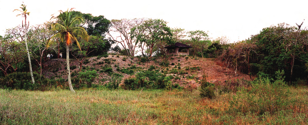
The Wilsons’ house was ultimately completed and named “GraMar Villa” after a combination of the names Graham and Mary. The main entrance was on the south, and two large brick fireplaces graced the interior on the east and west walls of the main floor. GraMar Villa still stands on Waterfront Drive, across from Brown’s Complex Mound 5, and today is known as the Tarpon Lodge. (Only one of the twin fireplaces remains, and the main entrance is now where the eastern fireplace was located.) The Wilsons built twin, cypress-wood boat houses at the shore line near their home. Across the street on BCM5 they built a cottage and three-car garage for Mary’s sister. This cottage, locally known as the Harris Cottage, is occupied today; the garage has been converted into a studio.
Wilson also built a house for his foreman, as well as a citrus packing barn and a 100-foot-long residence for the farm workers. Wilson’s activities extended to the court we call Brown’s Complex Court 1. Ted Smith remembered that, like today, BCC1 always appeared as a depression. He also noted that Wilson filled it with 3 or 4 feet of “marl-rich dirt and stuff ,” making a rose garden there. He also kept there a mule and a shed. Both the rose garden and the mule shed suggest that BCC1 was open to the sun, unlike today. In the 1920s and 1930s, muck for enriching the flower garden’s soil in BCC1 was dug from a 3-acre, 3-foot-deep pond, which we believe is the “four to four- and-a-half-acre” lake described by Cushing in his 1895 notes.
At about the same time, Graham Wilson hired a crew to dig a channel out from Pineland into Pine Island Sound. This is now the entrance to the intracoastal waterway, and is still listed on maps and referred to locally as “Wilson’s Cut.” Ted Smith remembered working on the project: “We dug nine feet of solid rock out of that channel, to make the channel thirty feet wide. Under that nine-foot layer of rock we dug up pine trees that big around [indicating about three feet], with bark on them.”
At the western foot of RCM2 today, with a view of Pine Island Sound, sits a house that was said to have been built by Wilson for his two unmarried sisters. We do not know the construction date, but we estimate 1926. The history of an associated garage building behind it is unknown but it appears in the 1944 aerial photo, along with the house, so it is at least that old. As mentioned earlier, Harrsen’s house on the top of RCM1 burned down in 1927.
To be continued in the next issue: Part 3: Recent History of the Pineland Community
This article was taken from the Friends of the Randell Research Center Newsletter Vol 8, No. 4. June 2009.