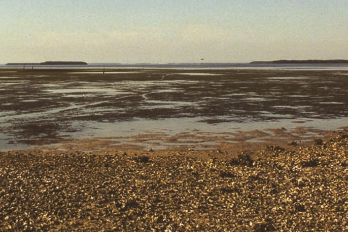
Visitors to Pineland can view Part Island directly from the observation pier at the Randell Research Center. It is visible 2½ miles across open, shallow water. At an extremely low tide, it might be possible to “walk” to Part Island; that is, if you don’t mind getting stuck in the mud or falling into a hole!
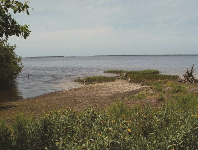
Part Island is actually two islands separated by a narrow mangrove tunnel and a lagoon. East Part Island faces the Pineland complex. It consists of 100 acres of mangroves with a clearing on the north end. The ruins of an old cottage with an active artesian well lie near a rickety pier that extends into the lagoon. A small open space marks where fruit trees once stood. East Part Island is privately owned and protected.
West Part Island faces Useppa Island across a ten-footdeep channel in Pine Island Sound. A private pier of recent construction enters the Sound. West Part Island is ¾ mile long from north to south, and consists of 120 acres fringed with mangroves. West Part Island has at least five acres of uplands. It is also privately owned and protected.
The surrounding waters are managed by the Pine Island Sound Aquatic Preserve, which protects mangroves, sea grasses, salt marshes, oyster communities, and tidal flats. The islands immediately east and south of Part Island are known as Black Key, Cove Key, and Coon Key, and they are under federal protection by the Pine Island National Wildlife Refuge.
Archaeologists ask a compelling question: Is the history of Part Island connected to the Pineland site? It is certainly geologically connected. According to studies soon to be published in a new book edited by William H. Marquardt and Karen J. Walker, The Archaeology of Pineland: A Coastal Southwest Florida Site Complex A.D. 50-1710 , one period of relatively low water occurred between A.D. 200 and 300, another between A.D. 400 and 450, and another between A.D. 600 and 900. The most recent period of low water occurred from about A.D. 1050 to 1100. During those dry periods, native people could have either walked to Part Island or paddled their canoes through a channel leading there. In 2003, Dr. John Worth, then the coordinator at the Randell Research Center, and Dr. Ernest D. Estevez, former Director of the Center for Coastal Ecology, Mote Marine Laboratory, searched the watery muck for a submerged terminus of the Pine Island Canal. After many soundings they determined that the canal extended toward Part Island for several hundred more yards than is apparent today. The westernmost boundary of the observed canal was marked by oyster bars that are now hidden below the surface.
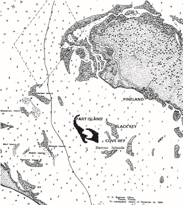
Historically, in 1899 an island shaped like Part Island appeared on a chart prepared by the U.S. Engineer Office. It formed the northernmost boundary of a group of islands called the Barras Islands. Barras is Spanish for bars . This group of islands appeared to have been oyster bars colonized by dense thickets of mangroves, separated from Pine Island and from one another only by very shallow water.
The first documented archaeological exploration of the Part Islands occurred in 1895 by Frank Hamilton Cushing of the Smithsonian Institution. He described “shell banks that rose to platforms that ascended to heights of extensive mounds that surrounded a lake or central lagoon.” Cushing also described steep embankments of shell walls surrounding a settler’s complex. He observed “graded ways that led to canals extending northwest and northeast.” He said that other extensive mounds “radiated easterly and southerly” from the central lagoon. He found potsherds and tools made of shell.
After visiting the island, Cushing wrote in his journal the first mention of his famous hypothesis that bands of ancient key dwellers, the “primeval fisherman of nature,” built huts on stilts over shell and established mound cities. He wrote that their discarded food shells reinforced the stilts below grade and stabilized the foundation. He thought that perhaps these stilt complexes existed around the margins of lagoons. He ventured that the island he explored “is an exceptional example of an ancient city with all of the aspects of artificial construction.”
Back in Washington, D.C., his notes and his hypothesis captured the imagination of many of his colleagues. It evoked ridicule from others. How could ancient peoples undertake artificial construction projects using only shells? Cushing bolstered his argument with direct observations of local topography and compared it with portions of the Bahamas, Antilles, Cuba, the Yucatán, and other Gulf Coast sites. Large shells appeared to Cushing to have been arranged in an orderly manner. Extensive shell and sand structures were separated by canals. Although Cushing was certain that Part Island was a perfect example of an ancient shell city, archaeologists now understand that the shell middens in Pine Island Sound formed from a combination of human activities and changing environmental conditions. Lacking knowledge of sea-level fluctuations that played a prominent role in the deposition of discrete shell layers, Cushing imagined that episodic deposits of shells were entirely caused by people constructing “foundations.”
Frank Cushing was a pioneer in Southwest Florida archaeology, and many of his observations have proven to be well justified. He died before publishing his remarkable manuscript. After his death, his notes, maps, and field journals were organized by his good friend and colleague, John Wesley Powell, the famous explorer of the Grand Canyon; however, they were not completed at the time of Powell’s death. The manuscript was lost for 110 years.
In 2003, archaeologist Phyllis Kolianos discovered Cushing’s lost manuscript and journals at three diverse locations: the National Anthropological Archives at the Smithsonian, the Southwest Museum of Los Angeles, and the Brooklyn Museum. The lost manuscript and journals were published in 2005 in two volumes, The Florida Journals of Frank Hamilton Cushing, and The Lost Florida Manuscript of Frank Hamilton Cushing, edited by Kolianos and Dr. Brent Weisman. (These books can be purchased at the RRC gift shop.)
Today’s archaeologists have asked whether the island that Cushing described was indeed Part Island. In his manuscript, Cushing described the exact route that his sailing vessel followed. “Descending the channel which leads from the northern portion of Charlotte Harbor into Pine Island Sound down past Patricio Key to a point some two miles southwestwardly from there, and about a mile and a half to the eastward of Useppa Island, one encounters in the very middle of the Sound one of the most remarkable of these keys. It is known as Caseys or Gardens Key and forms the northernmost of the so called Barras Islands” ( Lost Florida Manuscript , p. 46). The 1899 chart shows the shape and location of the northernmost island to be consistent with the shape and location of Part Island as it appears today on modern charts. Modern charts also show that West Part Island is directly east of Useppa. In addition, Cushing surveyed the area around the lagoon and estimated that the expanse was 5/8 mile long by 3/8 mile wide. This estimate corresponds with the modern dimensions of East Part Island. Cushing described the remains of a long-abandoned settler’s dwelling with fruit trees on one of the north platforms, mapping the locations of the “abandoned home, well sunk, lemon tree, shell mounds surrounding a lagoon, club heads, and pottery sherds.” Today, the ruins of a similar settlement with a well and a clearing are easily visible on a modern aerial photograph of East Part Island.
Since Cushing’s first exploration, no formal archaeological survey of Part Island has been attempted. Was Part Island occupied by the Calusa? Was it an extension of the Pineland complex? Did it predate the mounds at Pineland? These are intriguing questions. Only a systematic, professional archaeological exploration can provide the answer.
This article was taken from the Friends of the Randell Research Center Newsletter Vol 11, No. 3. September 2012.