In July, the Ohio State University (OSU) and the Randell Research Center began a pilot project using shallow geophysical survey techniques at the Pineland Site Complex.
Victor Thompson of OSU and Karen Walker and William Marquardt of the Florida Museum developed the project to evaluate the potential of geophysical survey to reveal buried archaeological features and help reconstruct past use of the landscape at Pineland. This season’s work focused on Surf Clam Ridge and Citrus Ridge near the central portion of the site.
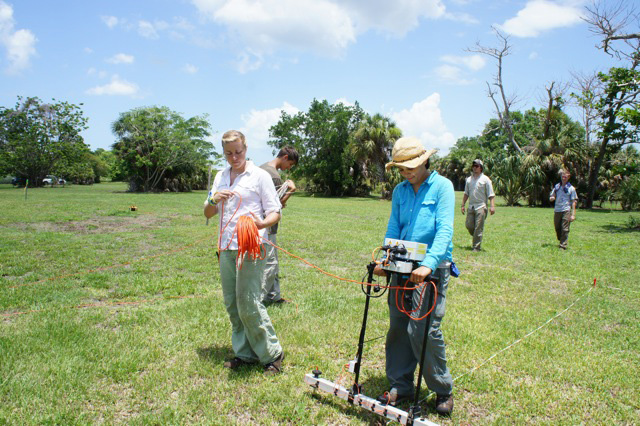
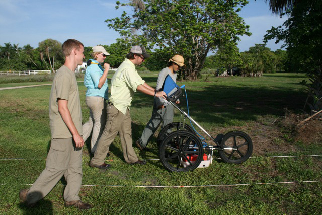
Over five days, the crew covered 18,400 square meters with electrical resistance survey and 5,090 square meters with ground penetrating radar (GPR). Analysis is ongoing, but preliminary results show disparate patterns across the site. On Citrus Ridge, the resistance survey identified underground variations that may indicate midden and redeposited sand. These data could help to answer questions about how human habitation and storm surges contributed to the formation of these landscape features. GPR survey on both ridges complements the resistance survey by providing a three-dimensional subsurface view of these landforms. Additionally, GPR survey around the site was successful in detecting the location of some of the smaller Calusa canals.
Future work will involve comparing the geophysical results with the previous excavation and coring data from Pineland. Comparing geophysical measurements with excavation data helps archaeologists to understand larger patterns in the distribution of archaeological features. Often, such patterns are revealed only through large-scale excavations, which are costly and destructive to archaeological resources. This research promises to be of interest both methodologically and for understanding the history of human occupation at Pineland,
What is shallow geophysical survey?
Shallow geophysical survey allows archaeologists to map subsurface features without excavation. Survey techniques use electrical currents, radar, or magnetic sensors to identify features that stand out in certain ways from the surrounding area. Underground walls, middens, ditches and other archaeological features may vary physically from the ground around them in various ways, such as reflecting electromagnetic signals, holding more or less moisture (affecting electrical conductivity/ resistivity), or altering the natural magnetic field of the soil. Measurements at standard intervals are compiled with computer software to create maps that show patterns over the survey area, which can reveal buried archaeological features.
This article was taken from the Friends of the Randell Research Center Newsletter Vol 10, No. 3. September 2011.