There are few places in Southwest Florida where evidence of people of the Late Archaic period through modern times is preserved. Calusa Island, separated from the Northern terminus of Pine Island by Jug Creek, is one such place.
In the June 2016 edition of this newsletter (available here on our website), we reported on the first phases of research and monitoring on North Beach of Calusa Island where exposed midden, dating to the terminal years of the Late Archaic (1200-500 BC), was crumbling away due to shoreline erosion.
Results of limited archaeological work showed estuarine conditions of the time were especially favorable for oysters. People also collected, ate, and discarded the shells of whelks, crown conch, quahog clams, and scallops. A variety of fish were captured too including gafftopsail catfish and pinfish. Analysis of ancient burned plants from midden layers showed that mangroves and pine trees grew in the area. And, the rate of shoreline loss was calculated at approximately 94 feet over 70 years with over 30 feet lost during the previous three decades.
In our December 2018 newsletter, we described the modified, monthly, midden measuring techniques and announced that the Florida Public Archaeology Network (FPAN) was also collaborating on the project. We also described the impact of Hurricane Irma, which cut away over 15 inches of one midden section and uprooted a gumbo limbo tree, exposing artifacts that were once safe under its roots.
The next phase of research is now complete after a weeklong project wrapped up on February 14. The project involved three types of archaeological investigation, each chosen to answer specific types of questions. We wondered how far the midden extended across the island and if it stretched into the mangrove fringe on the southern side. We wondered whether all the middens on the island were created from activities of Archaic people or if Indian people of later time periods might have been present also. We wondered what information about past environments might be found in the layers just inches below areas receiving heavy impacts from island visitors and from the profile of the eroding edge.
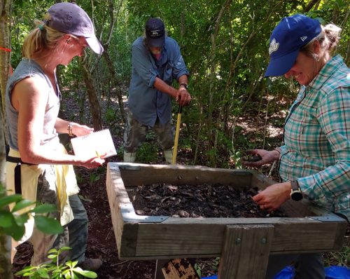
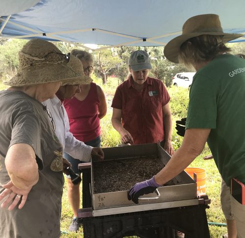
To answer the first question, we used a shovel test survey. Shovel tests are used by archaeologists to gather information with minimal impact. Holes are dug straight down, about 20 x 20 inches and less than 3 feet deep. Artifacts are recovered and soil types examined. Results can indicate areas of human activity and help guide future investigations.
We dug nine shovel test pits. All material from the pits was sifted through ¼-inch archaeological screens. Artifacts such as pottery or shell tools were removed for analysis. The placement of each hole was mapped using a total station, an engineering and surveying tool that allows measuring a position horizontally and vertically at the same time. Strangler fig and gumbo trees and white indigo berry and white stopper shrubs made for dense, shady, and humid work areas.
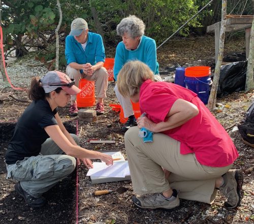
While crews worked on the arduous digging, another crew worked on the shoreline to make the jagged, eroding midden edge into a vertical, straight wall known as a profile. The profile was drawn in great detail and photographed in order to reveal the layers of deposition. These layers form by the actions of people, by processes of the environment, and by the combination of the two. The profile drawing revealed complicated deposits, not just simply one layer upon another. We also cut out and bagged, by layer, a column of the midden from the top to the exposed bottom in a process known as bulk column sampling.
At another area of the island, an excavation unit was opened. For our purposes, the unit was 1 meter by 2 meters (about 3 x 6 feet) and sediments were carefully removed and screened for each 10 centimeters (cm) of depth. Each such 10 cm – about 4 inches – is known as a level. After every 10-cm level, the profiles and the bottom were drawn, photographed, and any areas of potential features highlighted. “Features” may reveal the presence of past buildings, fire pits, etc. Artifacts were mapped in place and also recovered from the screens. Although the goal of an excavation unit is to reach the point where there is no longer evidence of people, with so few days and the work proceeding with due care, we concluded the unit at about 20 inches below the surface.
The next phase of work has begun at our Ruby Gill House labs and involves washing, sorting, and labeling of materials from the shovel test pits and excavation unit. Extreme care is taken to insure the exact location where individual items or features came from. These finds are recorded on a permanent catalog. The column sample materials are being water screened so that even tiny fish bones and shells can later be identified, counted, and used to create a view of the environmental conditions of the past.
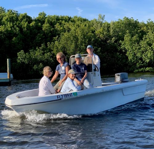
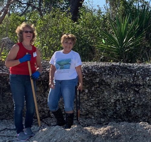
Members and benefactors of the Randell Research Center help make this work possible. RRC staff members worked on-site, coordinated all logistics, and will supervise the ongoing preparation of field materials for analysis. The Board of the Calusa Land Trust granted permission for the work to take place on their parcels. Island landowners Bill Spikowski, Alison Ackerman, Gloria Andrews, and Ed Chapin also granted permission and provided essential back-ground information and support. Florida Public Archaeology Network staff members Rachael Kangas, Sara Ayers-Rigsby, Victoria Lincoln, and Mallory Fenn provided field leadership and expertise. Florida Museum Assistant Curator Michelle LeFebvre and RRC Co-Director Karen Walker are the lead investigators. Michelle supervised all fi eld work. RRC staff member Andy Jendrusiak piloted a boat loaned to us by “Spike” Goehry. Robert Ballard, President of the Calusa Land Trust, ferried crews to and from the island each day in his boat, as did Ed Chapin. Over 15 RRC volunteers were involved in field work and in educating the visiting public about the activities. We could not have accomplished the investigation of this unique site without their dedication.